Precise location of underground tanks and pipes not only determines the efficiency and safety of projects, but also impacts costs and timelines. Electronic utility locators, equipped with state-of-the-art technology, provide an advanced solution, making it possible to uncover even the most elusive underground assets. These tools combine intuitive design with high accuracy, ensuring that professionals can reliably pinpoint utilities and gather crucial data for their operations. Let's delve deeper into some of the top electronic utility locators.
Subsite Electronics UtiliGuard 2 RTK
The UtiliGuard 2 RTK receiver from Subsite Electronics was designed as a simple, easy-to-operate utility locating tool for operators locating, mapping and capturing underground utilities. It utilizes survey-grade technology and features dual-band antennas to provide operators with reliable positioning data with centimeter-grade accuracy. Its precision helps when locating abandoned and untracked utilities that are difficult to pinpoint. By quickly verifying the utilities installed, operators efficiently tailor bids to match a job site needs, as well as gain insight into the underground infrastructure to avoid cross bores during future projects. The receiver provides locate crews with integrated data capture, GPS positioning and an intuitive user interface to improve work quality and maximize locate awareness. By downloading the MyUtiliGuard application, operators simplify and streamline how they capture, map and share data. 800-846-2713; www.subsite.com
Vivax-Metrotech vLoc3 RTK-Pro
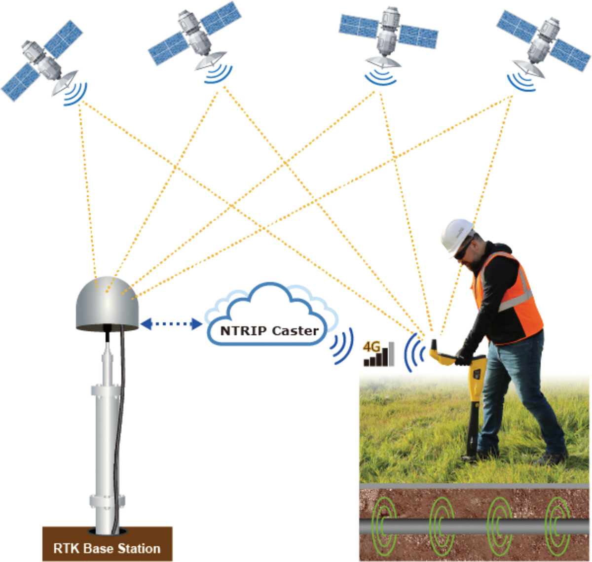
The vLoc3 RTK-Pro receiver from Vivax-Metrotech adds RTK GNSS accuracy to a utility locator. Using the internal cellular module with 4G LTE capabilities, the operator can connect to an NTRIP RTK (Real-Time Kinematic) caster that provides RTCM 3 corrections. By utilizing these corrections, the operator can collect both utility location data and the utility’s geographical location with survey-grade accuracy. It is designed for all operator levels, utilizing user-friendly and intuitive locate screens. Operators confirm the utility data with the press of a button and align the electronic spirit level to store data. All field data is sent to the cloud and retained in the receiver’s onboard storage for review and exporting to mapping programs. 800-446-3392; www.vxmt.com
Continue reading for free